Saturday, April 30, 2011

Life in La Paz

The Honcho has been berthed at Marina Palmira, just outside of La Paz for the last week. We've been touring the city, lounging by the pool, shopping for supplies and generally preparing to spend the next five or six weeks cruising among the islands and along the western coast of the Sea of Cortez.

La Paz is an interesting city. The area has been inhabited for thousands of years by indigenous people, but it's modern history began in 1535 when Hernan Cortez arrived and tried to found a colony here. That attempt failed, but in 1596 Sebastian Vizcaino set up shop here and established a successful colony along the shores of the beautiful Bahia de La Paz, which he named. From then until the mid-nineteenth century the city grew in importance as a commercial and transportation center.

In 1853 the town was occupied by one William Walker, an American whose ambition was to create a pro-slavery republic, called the Republic of Lower California. That did not sit well with the Mexican government and Walker's republic lasted only about four months. Not one to give up, Walker later set his sights on Nicaragua, which he invaded and actually set himself up as president of the country. His presidency lasted from July of 1856 to May, 1857, when a coalition of Central American governments defeated his forces and he fled to an American naval vessel and returned to the USA.

In 1860, Walker went to central America, this time to Roatan, where he was intent on setting up another independent state. His luck finally ran out when he was taken into custody by the British Royal Navy, which turned him over to the Honduran authorities who promptly put him before a firing squad.

I wouldn't call this city picturesque. It lies mostly on flat land that is reminiscent of the land around Blythe, except of course, for the magnificent bay on its western side. The climate here is also very Blythe-like.
Though it is on the east side of the Baja Peninsula, La Paz faces the Bahia de La Paz  on its west side. The city itself is protected from the bay by a large spit of land called El Mogote. This photo was taken from the International Space Station, courtesy of Wikipedia
It's geographical location is also unique. It lies at the base of a peninsula that juts north from the mainland of Baja California. This location gives it a climate that, while hot in the daytime, is fairly cool in the evenings due to the Coromuel winds that blow in from the Pacific Ocean, which is only about 35 miles away to the southwest.

With a growing population and a relatively high standard of living, La Paz is also the gateway to the Sea of Cortez for many cruising yachts. With it's low cost of living, cheap marinas and good access to the US, it also has a large and growing gringo community. We're ready to leave now,  but will wait a couple more days for some strong northerly winds to calm down.

While waiting for the weather window, I've had time to look at some interesting cruising boats and will post something on the J/130 as a cruising boat in the next day or two.


Sunday, April 24, 2011

Three Days in Puerto Balandra

Puerto Balandra sunset.

With a big Manson anchor and 100' of chain set, we were ready for a windy first night in Puerto Balandra, and the Coromuel did not disappoint. The gusty southwest wind blew 20-26 knots all night and the next morning, but all was safe and secure aboard the Honcho. The Coromuel blew each of the three nights we were in Balandra. Every morning we lazed around the boat waiting for conditions to ease enough to take the dink and go exploring and snorkeling, which was usually around 1100. We spent afternoons in the water and evenings  aboard the Honcho or on other boats in the bay. Puerto Balandra is nearly perfect, with crystal clear water, warm sun, brisk breezes and fabulous sunsets.


 Crystal clear water and blue sky in Balandra.


The famous El Hongo rock, located on the north shore of the bay.  Carved into this shape by the sea, this rock stood for  thousands of years. Then a few years ago, it fell over, a victim of time, weather and overeager tourists. But the locals got together and put it back together again.
The Honcho was boarded by this Mexican Navy patrol. These guys were all wearing flak jackets and carrying M-16's, except for the guy in black, who carried only a pistol. Always polite and courteous, their job is to keep tabs on the boats in their jurisdiction. We've been approached by Mexican Navy patrols several times, and boarded twice.


We spent three wonderful days in Puerto Balandra but were running low on supplies,so on Sunday, April 24th we weighed anchor and motored about seven miles to Marina Palmira, just outside of downtown La Paz. We'll spend a week or so here, exploring the city and provisioning for a month of sailing in the more remote parts of the Sea of Cortez.

Saturday, April 23, 2011

Ensenada de los Muertos to Puerto Balandra

The Honcho arrived at Ensenada de los Muertos in the middle of the night, anchoring well out in the bay. The next morning we moved in closer to the beach and, thrilled with the clear and warm water as well as the lovely view from the cockpit, we quickly donned mask and fins and cruised among the reefs and shoals along the edges of the bay. Later we took the dinghy ashore and explored the pristine beach as far south as the Bahia de los Suenos Hotel. We wandered up to the hotel which is perched on a rise a quarter mile back from the beach. We explored the grounds and bought a beer in the lounge. The place was exquisite, but empty so I asked the bartender if we could take a dip in the pool. He said, "Sure, certainly, go right ahead." So we spent a couple of hours sipping beers and swimming in the pool, vowing that we'd come back to this place again.


Dirt road from the beach to the hotel


View from the pool


Overlooking the bar is a vast model railroad with multiple levels and various gauges of track. Very cool.


We spent a couple of days in Ensenada de los Muertos, then headed north toward Puerto Balandra, about 45 miles away. To get there, our course took us north past Punta Arena de la Ventana, where we entered the famous, or notorious, Canal Cerralvo (Cerralvo Channel), leaving Isla Cerralvo to starboard. Sailing on a NNW course we passed Punta Coyote and entered the Canal de San Lorenzo, which passes between Isla Espiritu Santo and the mainland of Baja California. This channel runs in an east-west direction, and opens into the broad Bahia de La Paz. Passing through the channel, the view of the bay was fabulous. We bore off around Punta Tecolote and entered the picturesque bay called Puerto Balandra. We are now in the region where the Coromuel winds blow, so we came to anchor in the lee of the hills in a cove on the southwest side of the bay. Coromuels are winds that blow out of the southwest at night. In this bay they begin around 1900 in the evening, and blow throughout the night and into the morning, averaging 18 to 25 knots. Tucked in fairly close to the land, we experienced plenty of wind, but flat water, so in spite of the wind, nights have been comfortable here.

The water here is crystal clear and reasonably warm, 70 to 72 degrees. Snorkeling around the underwater rock ledges was an awesome experience, with clouds of brightly colored tropical fish all around. We'll stay here for a couple of days, then head into the city of La Paz.

Wednesday, April 20, 2011

Mazatlan to Ensenada de los Muertos

The Honcho was in the Mazatlan area for about three weeks, and while it is a beautiful city, we were ready to leave. I really enjoyed the old town and the crisp weather there, but the marina had a different atmosphere from La Cruz. It is older and quieter, with less to do that is within walking distance than Marina La Cruz. The murky, slimy water in this marina was by far the worst we’ve experienced and we were certainly ready for someplace new, preferably a place with warm, clear water, beach palapas, and a view.  So at 1800 on Saturday afternoon, April 16th, we checked out of the marina and, motoring against a three knot current, headed out of the harbor toward a little place called Ensenada de los Muertos, on the southeastern coast of Baja California.
Mazatlan Cruising Yacht


Unfinished waterfront mansion near the marina. It was eerie to wander around this place that was once someone's dream home but is now becoming a ruins.


Looking back toward the pretty Mazatlan skyline, it was a bittersweet feeling to know that our time on mainland Mexico is over.  With scant wind, we motored westward into the setting sun, looking forward to an easy 190 mile passage to the Bay of the Dead. Just after sunset, a full moon rose over the eastern horizon, giving us a glorious night of sailing. Our course took us slightly north of west, and at 2230 we crossed 23 degrees, 26.25 minutes north latitude, which is the Tropic of Cancer, taking us out of the tropics and into the sub tropic zone.  
Mazatlan's Gold Coast


When the sun rose the following morning we were forty miles offshore and the sea had turned from a murky green to a deep clear blue.  By 0900, a warm southerly breeze came up and we spent the rest of the day on a beautiful beam reach in 10-15 knots of wind.  We started trolling with a Mexican lure on 40 pound test line around 1000 in hopes of finally catching a dorado, but after three hours without a bite, I had forgotten that it was there.  Suddenly the reel lit up and I could tell by the way the line was zinging off the reel, we’d hooked something big.  I grabbed the rod and tried to reel it in, but got nothing. Then I saw why as a 5-6 foot marlin launched out of the water on our starboard beam.  There is no way we could handle a fish like that on the Honcho so I reached for the pliers to cut the line. By this time the fish had reversed course and once again launched out of the water a hundred feet off our transom. I managed to cut the line before he took all of it off the reel. The entire episode happened in the span of about ninety seconds. We were thrilled by the sight of such a fish, but glad to let the big fella go.

By nightfall, we were about forty miles from Bahia de los Muertos, still with a fine southerly breeze. We were greeted by another full moon in a cloudless sky just after the sun sank below the horizon. We had Polaris and the Big Dipper on our starboard beam, but the Southern Cross was no longer visible, being now well below the southern horizon.  It was interesting to see that the sea temperature rose from around 62 to 71 degrees as we sailed out of the Pacific Ocean and into the Sea of Cortez.

Around 2200, the wind dropped to almost nothing and we began motoring the last twenty miles toward Bahia de los Muertos.  At 0300 we slowly crept into the anchorage and dropped the hook.  The white sand beach and low hills surrounding the north and west sides of the bay were beautiful in the moonlight. We’re finally in the Sea of Cortez.

Monday, April 11, 2011

Copper Canyon


Rio Fuerte winds through the canyon. Notice the stone walls enclosing a Tarahumara farm in the foreground.


Barranca del Cobre, otherwise known as Copper Canyon, is Mexico’s version of Arizona’s Grand Canyon. It’s located about 350 miles north of Mazatlan in the State of Chihuahua. It is reputedly quite a spectacle, so we decided to take a road and rail trip upcountry and give it a look.

Leaving the Honcho in Marina Mazatlan, we boarded a bus to Los Mochis, about 280 miles up the coast. The landscape for nearly the entire distance was mile after mile of rich farmland which reminded me of the intensively farmed Imperial valley of California. This area is known as Mexico’s vegetable garden.  Along the way we passed through Culiacan, which is the home base for the Sinaloa drug cartel. Our bus didn’t stop there; we just rolled right through the sand bagged police checkpoints and kept going until we got to Los Mochis where we spent the night. As usual, we were the only gringos on the bus or in our hotel. The locals looked at us a bit strangely but were all very friendly. With all the news about drug violence in Mexico, we expected a lot of tension in this city, but we saw nothing to indicate that it's any more dangerous than any other city in Mexico, or the US...except for the sandbags around the highway checkpoints and police stations.

The next morning we boarded another bus to El Fuerte, where we spent another night. El Fuerte isn’t much, but it does have an old fort with a rusty old cannon that was apparently used during the Mexican revolution. The fort is supposed to date from the 1500’s when the first Spaniards arrived, but it is actually a replica, built 20 or 30 years ago. There is no remaining evidence of the original fort, not even the correct location, so the fort is the town's best guess as to what the original might have looked like, and where it actually was located. Still, they put it to good use, opening part of it as a museum and converting the central courtyard to a water tank, which provides the town’s drinking water. It’s not a pretty fort, but we went ahead and paid our ten pesos each to go in and look around. Ten pesos doesn’t buy much in Mexico and this museum tour proved it.
Rio Fuerte from the parapet of the fort.

We stayed at the Posada del Hidalgo hotel in El Fuerte.  It’s a very beautiful place with good food and an excellent view of the town and its best feature, the Rio Fuerte, which runs through it. We wandered around the town square for a while, but retired early to the upstairs bar to watch the sun set over the river.
Entrance to the Hotel in El Fuerte

Courtyard in the Hotel Posada del Hidalgo, El Fuerte

Swimming pool at the Posada Hidalgo

The next morning we boarded a train, bound for Bahuichivo, which is little more than a whistle stop.
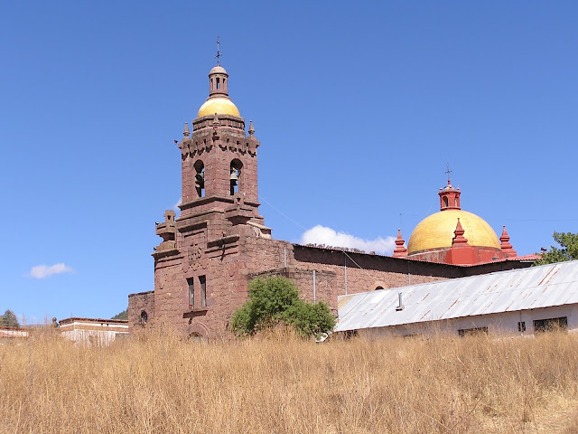
The train, called El Chepe, consists of a couple of passenger cars, dining car and a bar car and was quite nice. It hasn't been robbed in at least ten years so we felt pretty safe as we chugged up through the hills of the Sierra Tarahumara toward Bahuichivo. From there we got a car to the Hotel Mision in Cerocahui.  If Fuerte wasn’t much, Cerocahui was much less. We unloaded our bags at the hotel where they gave us a complimentary welcome margarita.  After looking around the place, I think it should have been a double. We wandered around the village, looked in on the 17th century church, then retired to our room and built a nice fire in the wood stove and relaxed. The next morning we drove up to the high country where the views of the canyon below were impressive. By noon we were back in Bahuichivo where we boarded the train to Posada Barranca.  The railroad, which runs from Los Mochis to Chihuahua City, is 390 miles long and includes 39 bridges and 86 tunnels. By itself, it’s a remarkable achievement, and with magnificent views of the canyon, it is an awesome experience.
Farm next to the train station in Bahuichivo


This stone church was built in the late 1600's. It was surprising to see such a grandiose building in the dusty village of Cerocahui.


Train to Copper Canyon, called the Chepe.

We arrived at Posada Barranca in midafternoon and took a car to the Hotel Mirador. It’s located in a beautiful spot, perched near the top of the canyon wall. I thought it was a bit expensive for my taste until we got to our room, one side of which was all glass with a veranda and a million dollar view of the canyon below.

Hotel Mirador at Posada Barranca.


I took lots of pictures of the canyon, but it is impossible for the photos to convey the true magnitude and grandeur of the place. It is actually a system of canyons created by a combination of tectonic upheavals in the earth’s crust and erosion by six rivers which converge in the canyon to form the Rio Fuerte, which eventually flows into the Sea of Cortez. This canyon system is larger, and in some places deeper than Arizona’s Grand Canyon. One guide told me that the canyon system encompasses over 54,000 square kilometers (roughly 21,000 square miles), but I could not confirm that. However, any way you look at it, this place is BIG. 

Afternoon view from our veranda.

Looking southwest down the canyon

The indigenous population in Barranca del Cobre is called Tarahumara. These people have maintained as much of their tribal identity and culture as possible, and it appears that the Mexican government is now taking an enlightened approach to helping these people with health care and other humanitarian needs without overwhelming their distinctive way of life.  There is much to know about these people who the early Spaniards called ‘The Running People’ because they had the ability to run enormous distances throughout this rugged country, which is probably too steep and rocky for horses or mules.

Tarahumara woman.  She was selling baskets at the canyon rim.
Tarahumara basket weaving.

Beautifully crafted Tarahumara baskets. The larger ones are made of fibers of cactus-like plants, the small ones are made of the long needles of the local pine trees.
The Tarahumara are reputed to be descendants of the Aztecs.

We were able to spend only a day and a half at Posada Barranca, which is not nearly enough time. I strongly recommend that you plan to spend at least four days there, or if you’re a hiker, spend a week. There is a new cable car there, the third largest in the world, and a new zip line tour which has to be one of the most spectacular in the world as well. Unfortunately we didn’t know about either of these and only had time to take the cable car.  We’ll be back one day to do the zip line.

The new aerial tram is the third largest in the world.

Cable car descends.

Lower tram terminal deep in the canyon.

After five days in the hinterland we returned to the Honcho, safe and sound in the marina. We’ll spend the next few days here preparing to leave the Mexican mainland and sail across the southern reaches of the Sea of Cortez to Bahia de los Muertos (Bay of the Dead) on the southeastern edge of the Baja California peninsula. 

Sunday, April 3, 2011

Mazatlan


Mazatlan is a City of Beautiful Beaches


"As for me, I am tormented with an everlasting itch for things remote. I love to sail forbidden seas, and land on barbarous coasts."

Herman Melville, in Mazatlan March 28 - April 16, 1844


Fog rolls in near Playa Olas Altas

Mazatlan is a city with an interesting past. In its prehistory, the area around the present city was inhabited by natives called Totorames. In 1531 a group of Spaniards arrived and founded a settlement here, but for three centuries it was little more than a stopover for passing ships and a hideout for the occasional pirate vessel, and by the 1820's it was still a village.

In 1847, in its first foreign invasion, the United States occupied the port of Mazatlan. Then the French followed suit in 1864. This was apparently in response to a group of Confederate soldiers taking over the place with the quixotic idea of forming a Confederacy south of the Border. Then the British, not to be outdone, briefly occupied the place in 1871.

Revolution came to Mexico in 1910 and Mazatlan earned the distinction of being the second city (after Tripoli) ever to be bombed in an aerial attack. It seems that one General Carranza in an effort to take the city ordered a biplane to drop a bomb made of nails and dynamite wrapped in leather on Neveria Hill. Naturally the bomb landed in downtown instead, killing two and wounding several others.
Downtown Plaza

After the revolution ended in 1917, things settled down in Mazatlan and it entered a period of more or less prosperity. More in the 1920's, less during the Great Depression and WWII. Today it is a prosperous port city with beautiful beaches and a magnificent old town. Of course there have been a few setbacks recently. The current global recession has hurt both tourism and business in the port. Mazatlan is also the primary port in the State of Sinaloa, home of one of the most prominent drug cartels in Mexico. There has been enough drug related violence here to cause many cruise lines to stop calling here, at least for the present. This has resulted in a lot of closed up beach palapa restaurants, much to my chagrin. Nearly all of the locals I've talked to blame Mazatlan's bad economic times on the drug violence, and indirectly on the demand for drugs in the US.

Anyway, we had a great time wandering around the city, enjoying the splendid architecture and excellent food here. The city is graced with beautiful beaches and near perfect sunbathing weather.
Locals relaxing at Playa Olas Altas

Friday, April 1, 2011

Isla Isabel to Mazatlan

The Honcho departed Isla Isabel in the late afternoon heading in a northerly direction toward Mazatlan on starboard tack. Almost as soon as we cleared the island the wind piped up to about 20 knots so we put a reef in the main and had a nice sail for about 40 miles. Around midnight we were about 3 miles off the beach just north of Teacapan and tacked to port.  This put us on on a course of due west and we got a taste of punching into the short, steep waves common to this area... a fairly bumpy ride. By 0100 the wind had settled down a bit and shifted so we were able to tack once again an sail a course nearly directly toward Mazatlan. Just before the moon rose at about 0330, the wind died completely and we motored the last 35 miles to the city, coming to anchor in the lee of Isla Piedra with about ten feet of water under our keel. The distance traveled from Isabel was about 90 miles. This is a well protected anchorage and we secured the boat and slept for a few hours.

Later that day we went ashore in the dinghy and walked down the beach a mile or so, looking at dozens of deserted beachfront palapa restaurants. We finally found one that looked open and wandered in. I asked why all the palapas were deserted and the waiter said this beach used to be very busy until a few weeks ago, when the cruise ships stopped calling at Mazatlan. There has apparently been enough drug cartel related violence to cause them to suspend calling at this port until they get a better handle on security here. Mexicans say its America's fault, because if the demand for drugs in the US didn't exist, Mexico wouldn't have a drug war on its hands. Either way, the mahi mahi tacos were excellent, the service good and the Pacificos were frosty. Speaking of frosty, we've been in temperatures that ranged from the 70's to 90's day and night for the last three months. Here the highs are in the mid 70's and low last night was 51. We've had to bundle up in fleece at night for the first time since leaving Long Beach.

The next day we went out to Isla de los Chivos and hiked to the top of the island. The views of the city and surrounding countryside were beautiful. Chivo is Spanish for kid, or young goat, and we got lots of pictures of the feral goats that live on this craggy little island.

After a couple of days in the peaceful tranquility of the anchorage, we got the anchor up and sailed around the west side of the city and took a berth in Marina Mazatlan, where we'll stay a couple weeks and explore the city and surrounding area.

The volcanic rocks around Isla Isabel. This one is called Isleo Mona Mayor

Looking east from the top of Isla de los Chivos toward Isla Cardones

A deeply laden purse seiner enters the harbor.

It looks like the goat is in the tree but he's not.

A 'chivo' surveys the rocky path below.
This little guy seemed happy to pose for the camera.
Itty bitty chivo hooves