 |
| Rio Fuerte winds through the canyon. Notice the stone walls enclosing a Tarahumara farm in the foreground. |
Barranca del Cobre, otherwise known as Copper Canyon, is Mexico’s version of Arizona’s Grand Canyon. It’s located about 350 miles north of Mazatlan in the State of Chihuahua. It is reputedly quite a spectacle, so we decided to take a road and rail trip upcountry and give it a look.
Leaving the Honcho in Marina Mazatlan, we boarded a bus to Los Mochis, about 280 miles up the coast. The landscape for nearly the entire distance was mile after mile of rich farmland which reminded me of the intensively farmed Imperial valley of California. This area is known as Mexico’s vegetable garden. Along the way we passed through Culiacan, which is the home base for the Sinaloa drug cartel. Our bus didn’t stop there; we just rolled right through the sand bagged police checkpoints and kept going until we got to Los Mochis where we spent the night. As usual, we were the only gringos on the bus or in our hotel. The locals looked at us a bit strangely but were all very friendly. With all the news about drug violence in Mexico, we expected a lot of tension in this city, but we saw nothing to indicate that it's any more dangerous than any other city in Mexico, or the US...except for the sandbags around the highway checkpoints and police stations.
The next morning we boarded another bus to El Fuerte, where we spent another night. El Fuerte isn’t much, but it does have an old fort with a rusty old cannon that was apparently used during the Mexican revolution. The fort is supposed to date from the 1500’s when the first Spaniards arrived, but it is actually a replica, built 20 or 30 years ago. There is no remaining evidence of the original fort, not even the correct location, so the fort is the town's best guess as to what the original might have looked like, and where it actually was located. Still, they put it to good use, opening part of it as a museum and converting the central courtyard to a water tank, which provides the town’s drinking water. It’s not a pretty fort, but we went ahead and paid our ten pesos each to go in and look around. Ten pesos doesn’t buy much in Mexico and this museum tour proved it.
 |
| Rio Fuerte from the parapet of the fort. |
We stayed at the Posada del Hidalgo hotel in El Fuerte. It’s a very beautiful place with good food and an excellent view of the town and its best feature, the Rio Fuerte, which runs through it. We wandered around the town square for a while, but retired early to the upstairs bar to watch the sun set over the river.
 |
| Entrance to the Hotel in El Fuerte |
 |
| Courtyard in the Hotel Posada del Hidalgo, El Fuerte |
 |
| Swimming pool at the Posada Hidalgo |
The next morning we boarded a train, bound for Bahuichivo, which is little more than a whistle stop.
The train, called El Chepe, consists of a couple of passenger cars, dining car and a bar car and was quite nice. It hasn't been robbed in at least ten years so we felt pretty safe as we chugged up through the hills of the Sierra Tarahumara toward Bahuichivo. From there we got a car to the Hotel Mision in Cerocahui. If Fuerte wasn’t much, Cerocahui was much less. We unloaded our bags at the hotel where they gave us a complimentary welcome margarita. After looking around the place, I think it should have been a double. We wandered around the village, looked in on the 17th century church, then retired to our room and built a nice fire in the wood stove and relaxed. The next morning we drove up to the high country where the views of the canyon below were impressive. By noon we were back in Bahuichivo where we boarded the train to Posada Barranca. The railroad, which runs from Los Mochis to Chihuahua City, is 390 miles long and includes 39 bridges and 86 tunnels. By itself, it’s a remarkable achievement, and with magnificent views of the canyon, it is an awesome experience.
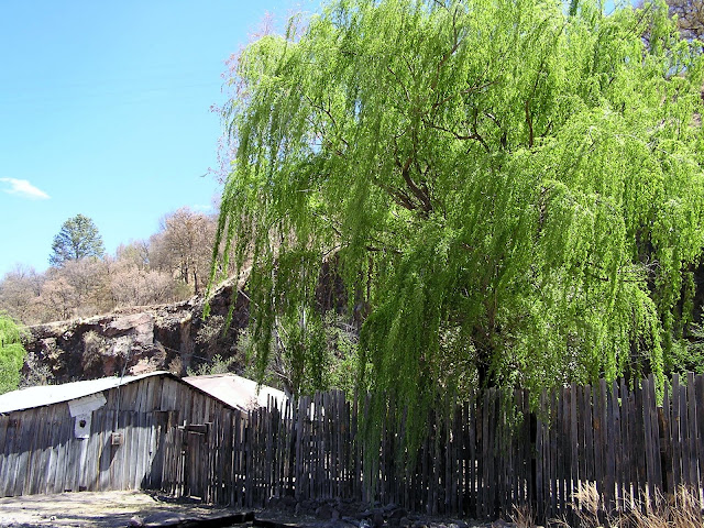 |
| Farm next to the train station in Bahuichivo |
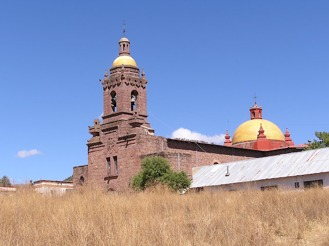 |
| This stone church was built in the late 1600's. It was surprising to see such a grandiose building in the dusty village of Cerocahui. |
 |
| Train to Copper Canyon, called the Chepe. |
We arrived at Posada Barranca in midafternoon and took a car to the Hotel Mirador. It’s located in a beautiful spot, perched near the top of the canyon wall. I thought it was a bit expensive for my taste until we got to our room, one side of which was all glass with a veranda and a million dollar view of the canyon below.
 |
| Hotel Mirador at Posada Barranca. |
I took lots of pictures of the canyon, but it is impossible for the photos to convey the true magnitude and grandeur of the place. It is actually a system of canyons created by a combination of tectonic upheavals in the earth’s crust and erosion by six rivers which converge in the canyon to form the Rio Fuerte, which eventually flows into the Sea of Cortez. This canyon system is larger, and in some places deeper than Arizona’s Grand Canyon. One guide told me that the canyon system encompasses over 54,000 square kilometers (roughly 21,000 square miles), but I could not confirm that. However, any way you look at it, this place is BIG.
 |
| Afternoon view from our veranda. |
 |
| Looking southwest down the canyon |
The indigenous population in Barranca del Cobre is called Tarahumara. These people have maintained as much of their tribal identity and culture as possible, and it appears that the Mexican government is now taking an enlightened approach to helping these people with health care and other humanitarian needs without overwhelming their distinctive way of life. There is much to know about these people who the early Spaniards called ‘The Running People’ because they had the ability to run enormous distances throughout this rugged country, which is probably too steep and rocky for horses or mules.
 |
| Tarahumara woman. She was selling baskets at the canyon rim. |
 |
| Tarahumara basket weaving. |
 |
| Beautifully crafted Tarahumara baskets. The larger ones are made of fibers of cactus-like plants, the small ones are made of the long needles of the local pine trees. |
 |
| The Tarahumara are reputed to be descendants of the Aztecs. |
We were able to spend only a day and a half at Posada Barranca, which is not nearly enough time. I strongly recommend that you plan to spend at least four days there, or if you’re a hiker, spend a week. There is a new cable car there, the third largest in the world, and a new zip line tour which has to be one of the most spectacular in the world as well. Unfortunately we didn’t know about either of these and only had time to take the cable car. We’ll be back one day to do the zip line.
 |
| The new aerial tram is the third largest in the world. |
 |
| Cable car descends. |
 |
| Lower tram terminal deep in the canyon. |
After five days in the hinterland we returned to the Honcho, safe and sound in the marina. We’ll spend the next few days here preparing to leave the Mexican mainland and sail across the southern reaches of the Sea of Cortez to Bahia de los Muertos (Bay of the Dead) on the southeastern edge of the Baja California peninsula.


Leif, your photos are amazing! I'm really enjoying reading the blogs.
ReplyDelete-jim lee